파일:PtolemyWorldMap.jpg
둘러보기로 이동
검색으로 이동

미리 보기 크기: 800 × 547 픽셀 다른 해상도: 320 × 219 픽셀 | 640 × 438 픽셀 | 1,024 × 700 픽셀 | 1,280 × 876 픽셀 | 1,500 × 1,026 픽셀
원본 파일 (1,500 × 1,026 픽셀, 파일 크기: 867 KB, MIME 종류: image/jpeg)
파일 설명
| 설명 |
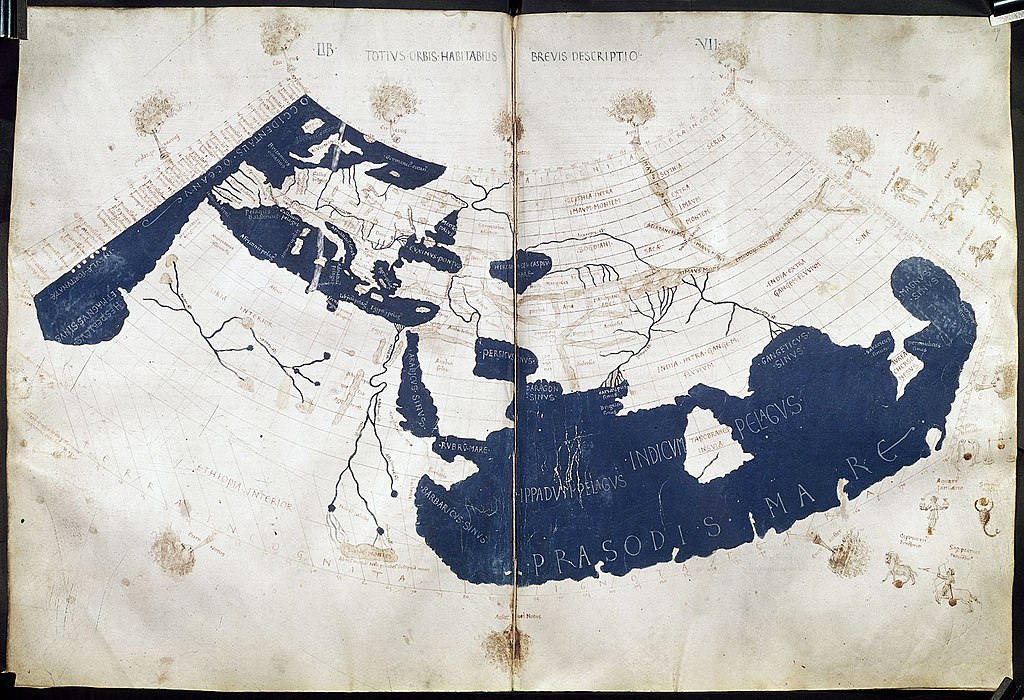
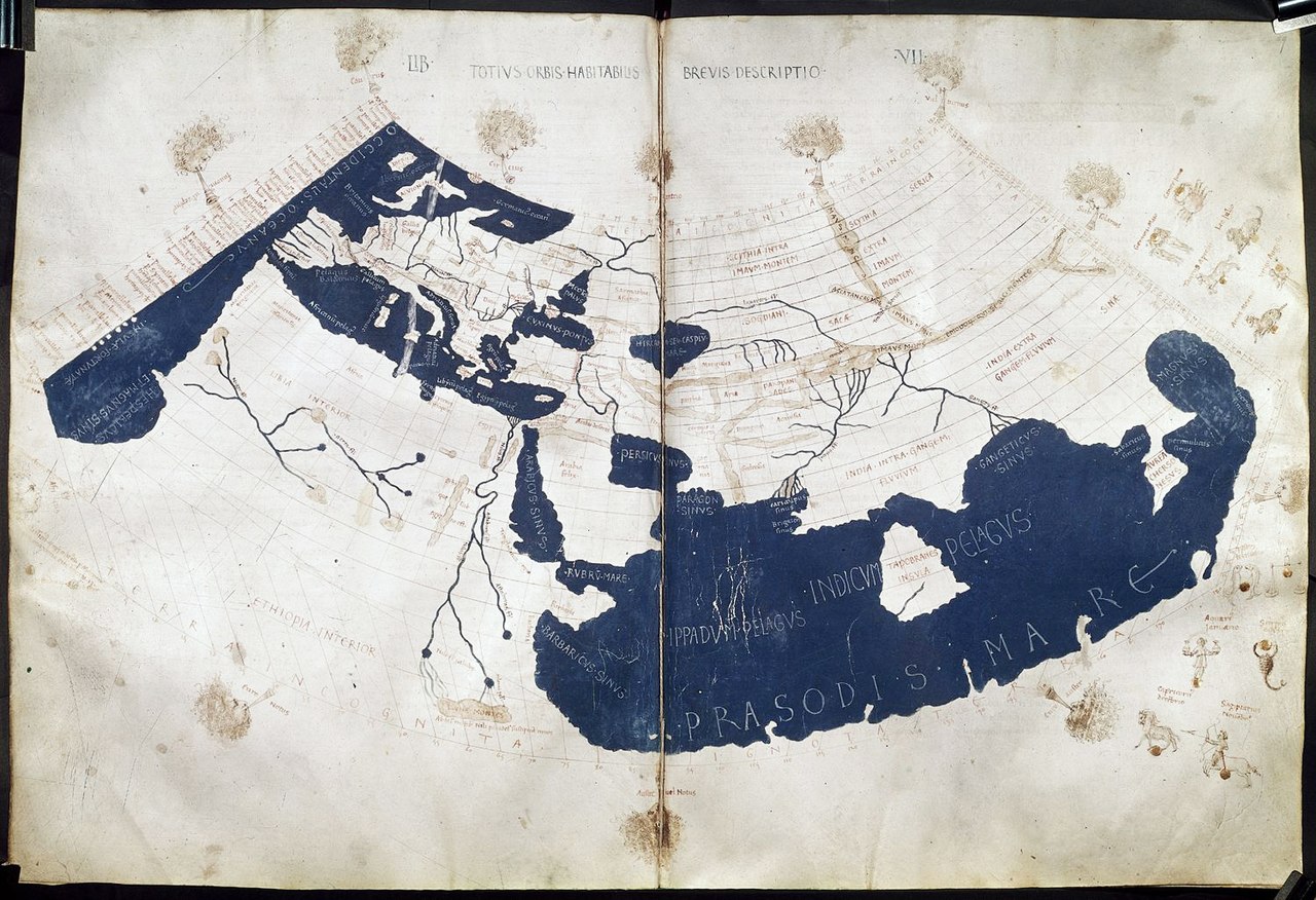
English: A mid-15th century Florentine map of the world based on Jacobus Angelus's 1406 Latin translation of Maximus Planudes's late-13th century rediscovered Greek manuscripts of Ptolemy's 2nd-century Geography. Ptolemy's 1st (modified conic) projection. 中文:《托勒密世界地图》,原为克劳狄乌斯·托勒密所著《地理学》书中所附的多幅地图,后来由君士坦丁堡的希腊修士马克西姆·普拉努德斯等人重新编集,并由14世纪的意大利学者雅各布·安格鲁斯译为拉丁文。该地图15世纪中期在佛罗伦萨出版。 |
| 날짜 | ad 1450–1475 |
| 출처 | Ptolemy's Geography (Harleian MS 7182, ff 58–59) |
| 저자 | Credited to Francesco di Antonio del Chierico |
라이선스
|
이 그림은 2차원 저작물에 대한 사진 복제본으로, 원본 저작물은 현재 저작권이 풀려 있는 퍼블릭 도메인 하에 있으며, 구체적인 정보는 아래와 같습니다.
위키미디어 재단에서는 2차원 저작물의 사진 복제본에 대해서 ‘2차원 퍼블릭 도메인의 사진 복제본은 역시 퍼블릭 도메인이라고 생각하며, 또한 이러한 주장은 일반적인 퍼블릭 도메인에 대한 개념으로, 이에 대한 반대는 일반적으로 사용되는 퍼블릭 도메인의 개념 자체를 반대하는 것이다’라고 입장을 밝혔습니다. 자세한 설명은 PD-Art 틀을 사용하는 경우 문서를 참조해주세요.
따라서, 이 사진 복제본은 역시 퍼블릭 도메인으로 간주됩니다. 그림을 사용할 때에는 해당 국가와 지역의 법을 확인해 주시기 바랍니다. 경우에 따라서는 관할 구역의 법에 의해 사용이 제한되어 있을 수 있습니다. 자세한 사항은 PD-Art 틀을 사용하는 경우를 확인해주세요. | ||||
| 주석 | 이 이미지에는 주석이 있습니다: 공용에서 주석을 보기 |
파일 역사
날짜/시간 링크를 클릭하면 해당 시간의 파일을 볼 수 있습니다.
| 날짜/시간 | 섬네일 | 크기 | 사용자 | 설명 | |
|---|---|---|---|---|---|
| 현재 | 2014년 7월 28일 (월) 00:02 | | 1,500 × 1,026 (867 KB) | wikimediacommons>Khamar | Larger scan from British Library retreived 2014-7-27 http://www.bl.uk/catalogues/illuminatedmanuscripts/ILLUMIN.ASP?Size=mid&IllID=28894 which has been slightly sharpened. Text clarity is improved in this version and the overall tint is less yellow. |
이 파일을 사용하는 문서
다음 문서 1개가 이 파일을 사용하고 있습니다: